

The Southern Plains Are Active Again: Upcoming Severe Weather In Texas, Oklahoma, Kansas, Arkansas, & More

Tornadoes were the story across Wisconsin yesterday and continue to be the story today across the Ohio Valley. It’s the result, among other aspects, of this strong mid-level trough and subtropical jet interaction below, which caused supercell and tornado formation around the St. Louis metro today and into Indiana.
The remnants of the Wisconsin tornado producing storms hit Southern Ontario in the overnight hours, producing torrential rain, small hail and prolific lightning around four in the morning. A similar event is expected tonight with elevated thunderstorms expected in a few hours.
The Coming Weekend And Into Monday & Tuesday
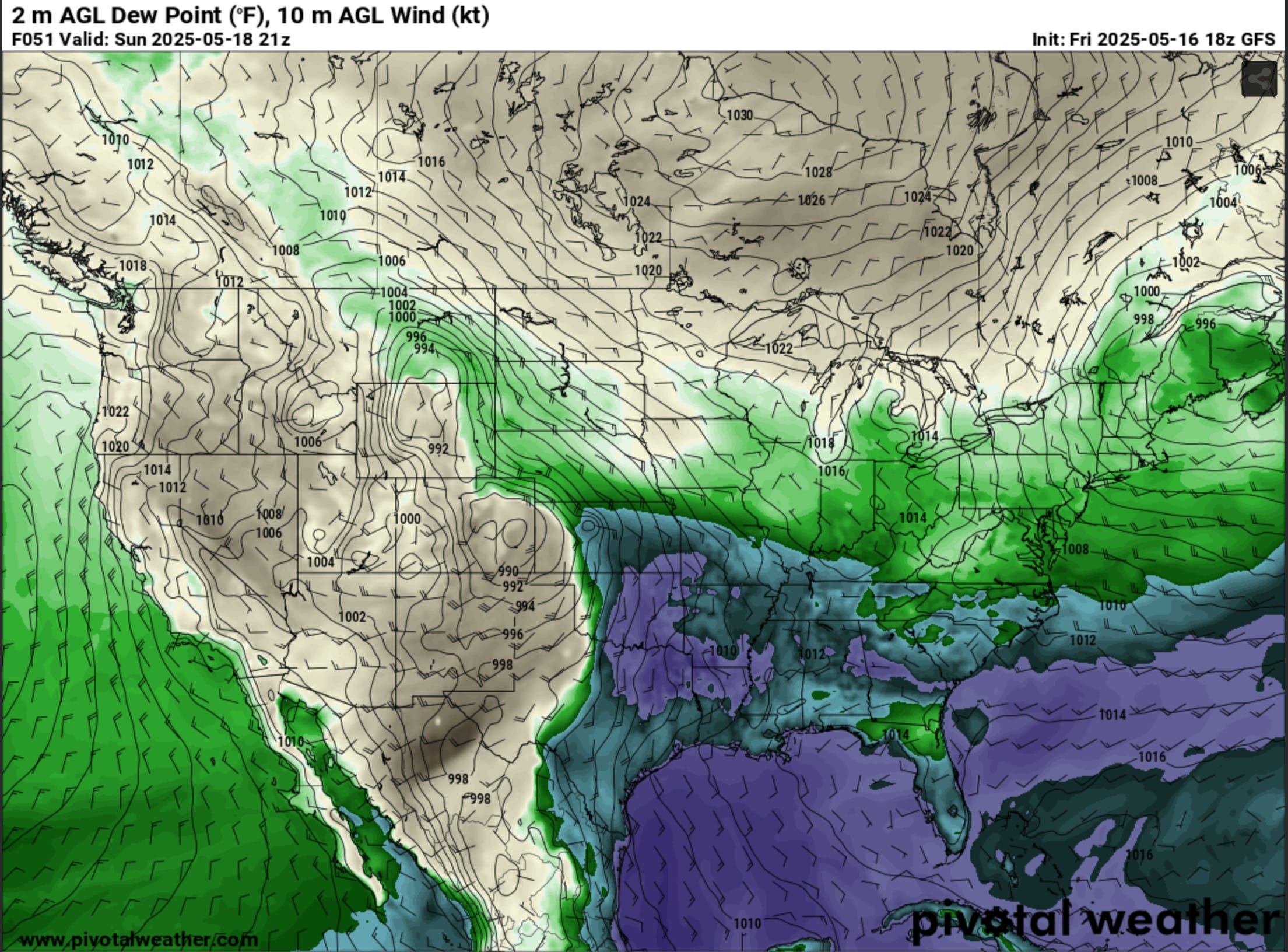
Switching to the US, a significant trough, with at least two embedded shortwaves (one near New Mexico for Sunday and the other coming down from Washington state on Sunday, which will introduce the threat for Monday and Tuesday), will lead to sustained southwesterly mid & upper level flow across much of the Southern Plains for several days. In tandem with strong moisture return and a strengthening low level jet, these storms, across all days, will pose an all hazards risks: tornadoes, hail, wind damage and flash flooding.
As of now, the two most potent days look to be Sunday and Monday, but Saturday may also introduce a severe/tornado risk across Oklahoma and northern Texas.
More aggressive runs for Sunday feature:
A coverage area of severe weather potential across central Kansas, Oklahoma and north Texas.
Notable dryline buldge (a focused area of storm formation).
Dew points into the low 70s (playing a part in energy and lower cloud bases).
High levels of surface based energy (upwards of 4000+ SBCAPE).
Abundant low level energy (100+ 3CAPE, allowing for stronger low level updrafts).
Strong low level jet, especially towards 00z (7 pm).
With dry air aloft, an LCL/LFC spread, a >10 degree temperature and dew point spreads and strong shear aloft (precipitation being vented away from the updraft), storms may avoid being high precipitation.
While areas closer to the surface low (Kansas) will feature higher Storm Relative Helicity (SRH), the environment further north will feature stronger capping, so storms may be late to fire, if at all.

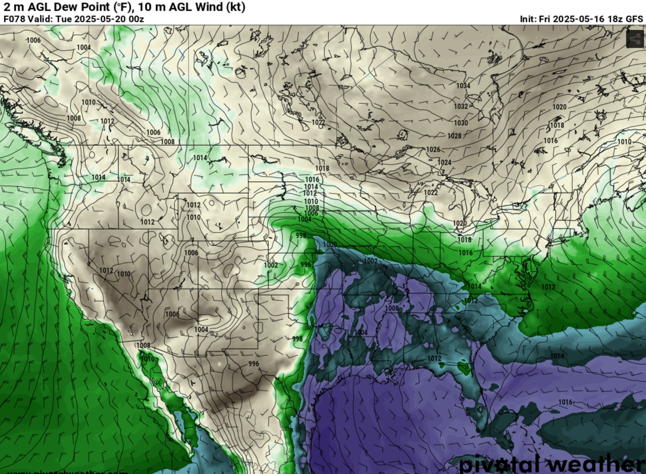
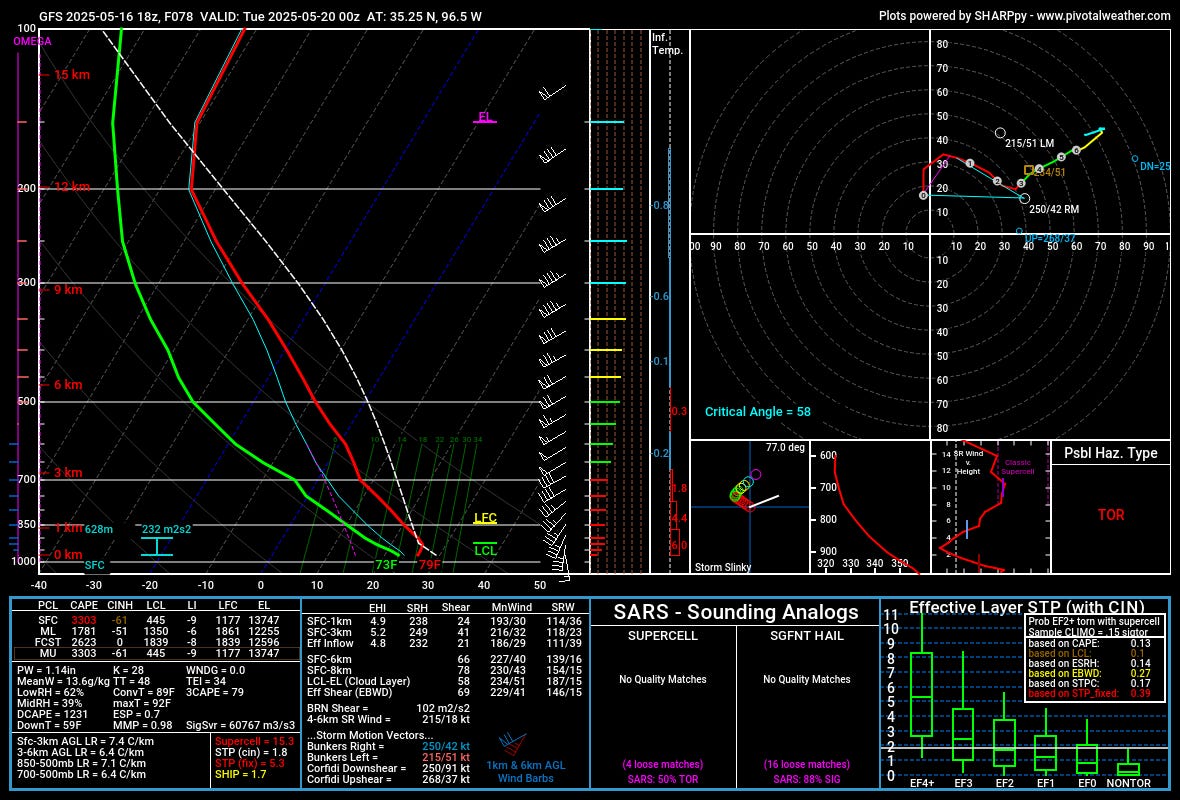
With the second shortwave trough expected to arrive in the Southern Plains on Monday, model runs feature:
Storm coverage area across central Oklahoma, Kansas and potentially Missouri.
A simular stout dryline across Oklahoma and into central Kansas (a focused area of storm formation).
Dew points into the low 70s once again (playing a part in energy and lower cloud bases).
Less surface based energy than Monday, but still plentiful (3000+ SBCAPE).
Abundant low level energy (75+ 3CAPE, allowing for stronger low level updrafts).
Strong low level jet, but arriving later than 00z this time (at least according to current model progs).
On Tuesday, the severe risk will shift further east as the trough ejects further east. This is getting a bit out of my comfort range for both synoptic coverage and mesoscale details, so I’ll address this later if the need arises.
Questions
With regards to both Sunday and Monday, there are still questions regarding Convective Inhibition coverage (capping), discrete storm formation vs quick upscaling, and outflow boundaries left behind from Saturday and Sunday storms.
Strong capping may delay storms until the overnight hours, or lesser capping with a stronger easterly dryline push may enable many storms to erupt at once in the prolific energy environment (upscaling). Outflow boundaries played key roles in the late April Texas Panhandle tornadoes, so storms that form the day before projected days may impact subsequent days. You won’t be able to forecast these mesoscale details well until the morning of.
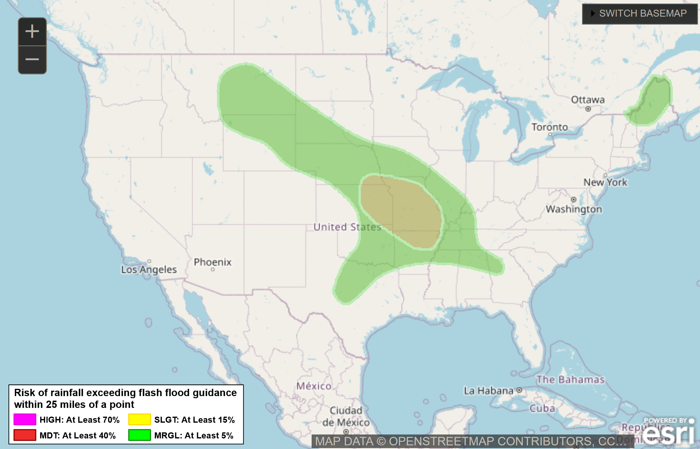
Lastly, with the southwest flow in place, storms that form across Oklahoma and Kansas should train over much of the same areas as they head downstream (we’re talking into Arkansas, Missouri and further downstream). Another hazard to be aware of.
Take care over the next few days if you live in those areas (and to my friends in those very areas now).