
Pattern Shift: Lake Effect Rain (Not a Typo) For The Usual Lake Effect Snow Regions

If you’ve been following my monthly Hamilton weather breakdowns, you’ll know much of Southern Ontario (and especially Eastern Ontario) has watched ridging take hold around here most of the summer and all synoptic storms avoid the area like the plague. The area has been in ongoing drought conditions for months now.
Heading into later October, starting last weekend, the pattern shift began. Steady rain and winds hit the Great Lakes area on Sunday (and wrecked some fantasy football team outcomes) and Tuesday/Wednesday are quite likely to see rain.
The main story of this post isn’t so much about YHM (Hamilton airport), it’s about a chance at plenty of lake effect rainfall in the same areas that usually see lake effect snow. This post is less about a major impact, which isn’t expected, and more about the meteorology behind the event. I’ll break it down.
Meteorology Behind Lake Effect Rain
I wrote a longer discussion behind how lake effect snow forms if you’re interested, but will give you the basics here. The principles apply to rain as well. This event would likely have been a big lake effect snow producer if it had come through in December.
At the very least, you’ll need:
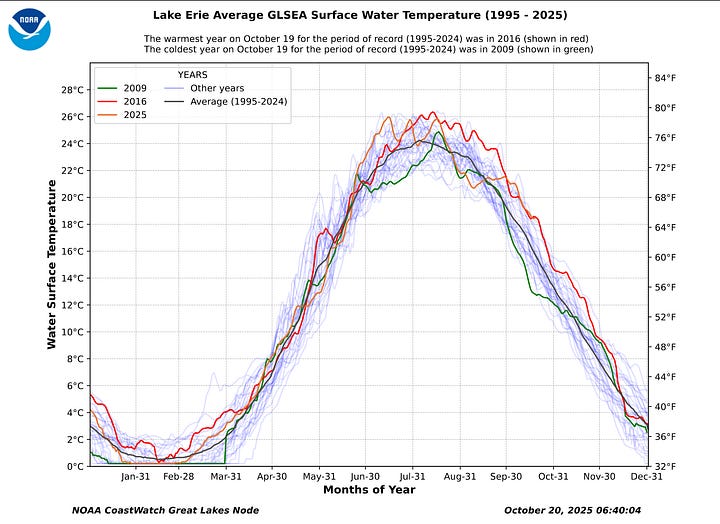
Warm surface water temperatures on the Great Lakes, relative to the much colder air above the surface. The first picture shows temperatures expected to be below freezing around 850 mb (5000 ft) and higher, while temperatures above Lake Erie’s surface (right) are around 19°C as of today. Lake Huron’s near surface temperatures are around 16°C.
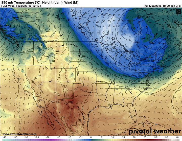
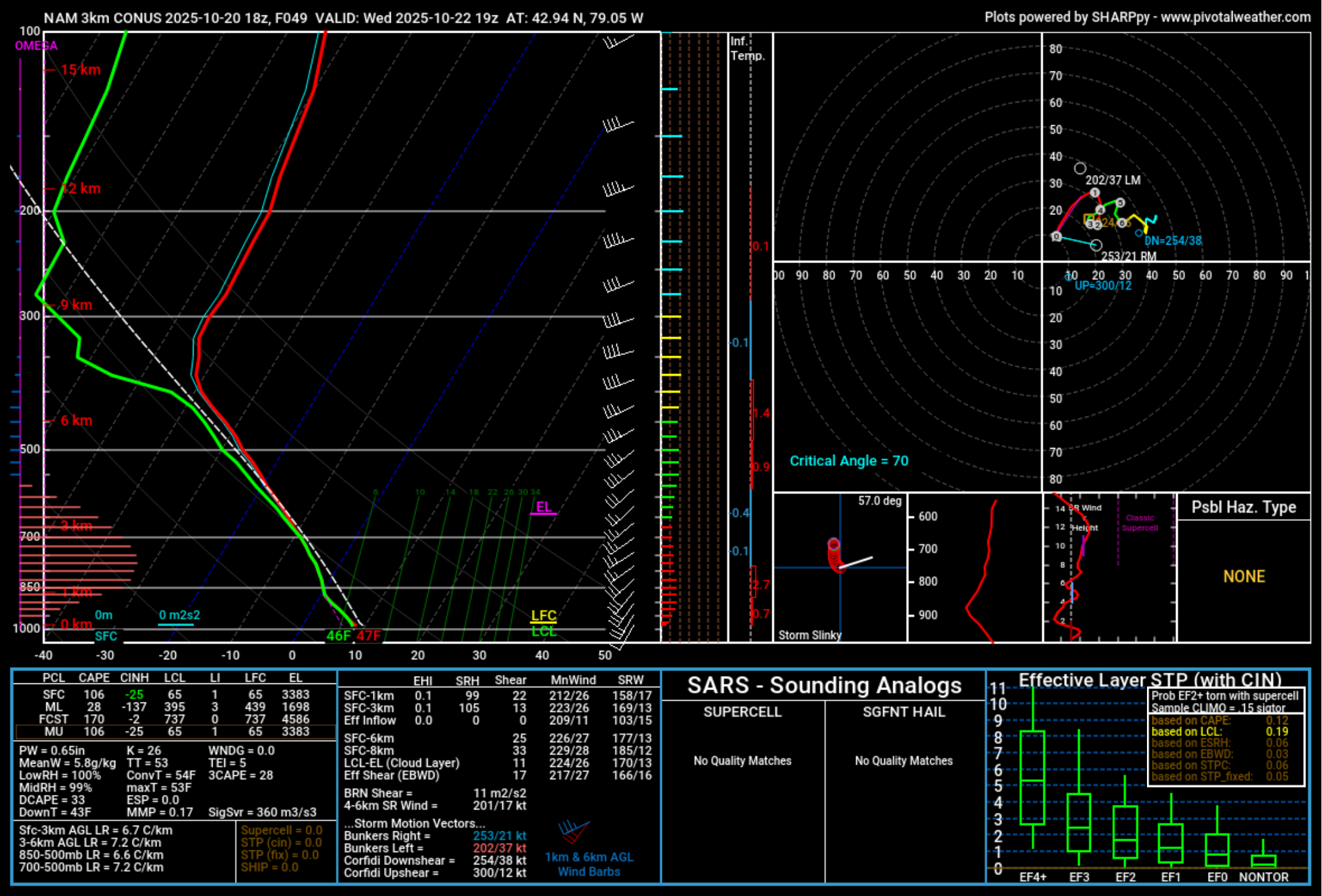
Sustained, unidirectional winds & cold temperatures above the lake that decrease further with height. The more pronounced this temperature change, the stronger the lapse rates & stronger the resulting convection. The needed temperature difference for convection to form is around 13°C from the surface to around 850-700 mb, which the sounding below shows we’ll get around Fort Erie/Buffalo.


A long enough fetch. The cold air must pass over the lake long enough to allow convection to form and build. If the wind does not have much residence time passing over the lake, weak or no convection forms.
The last point of note is frictional convergence: faster moving winds on the lake meets slower moving winds near the shoreline. This convergence zone allows for rising air and helps aid in convection formation.
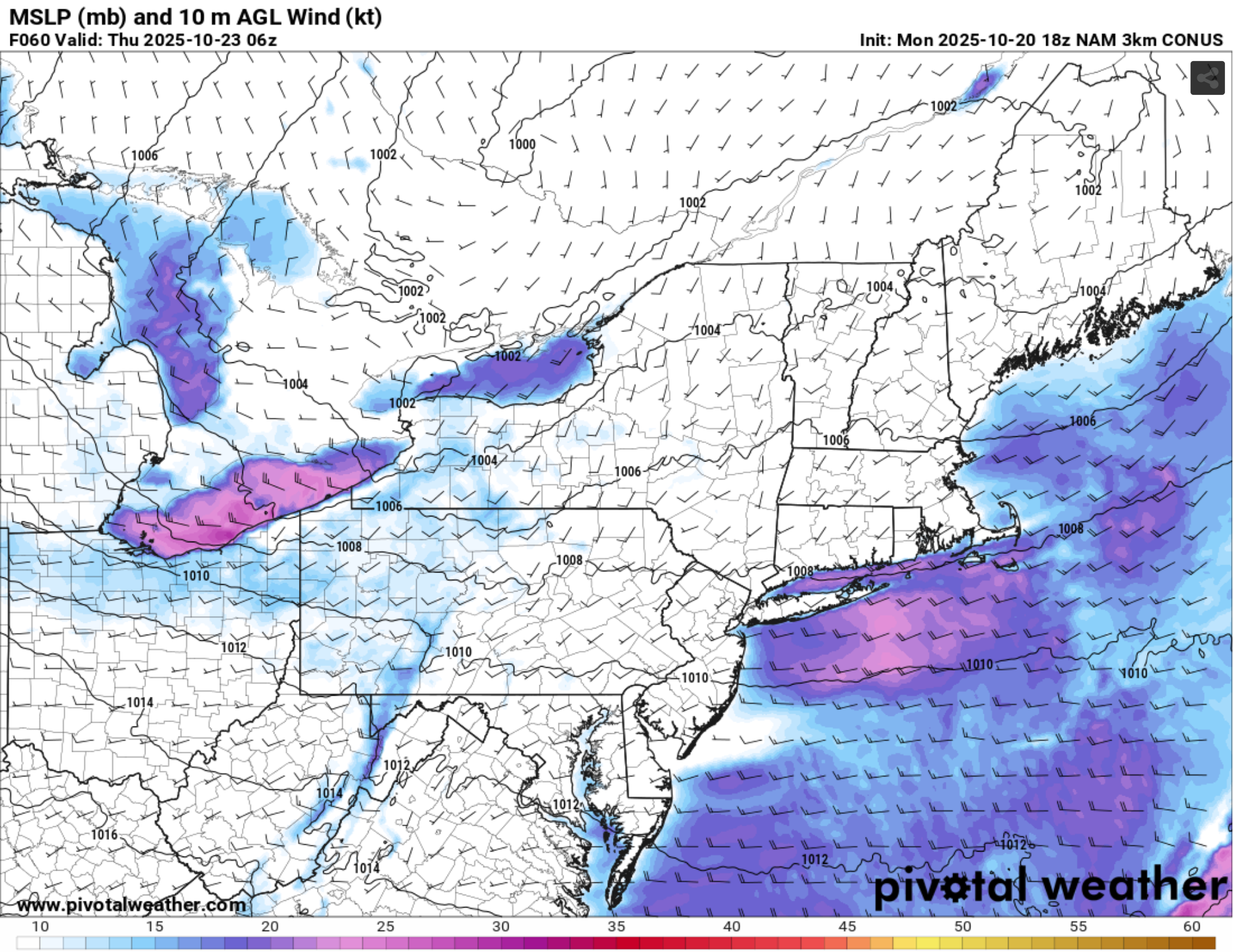
All of the above criteria are expected to be met for Wednesday and Thursday for parts of the snow belts, but with differing timing due to wind direction. The event itself will kick off when the low pressure system moves into the Great Lakes area early Wednesday, with a cold front passing through Tuesday morning.
The more notable colder air that will kick off the lake effect rain will come through Tuesday night into Wednesday and continue throughout the day. The wind direction will be WSW during this phase, so the Niagara region and Buffalo (and perhaps parts of north shore Lake Ontario) to get in on the rain at this phase. Note the SW/WSW winds off Lake Erie, though expect some slight deviations in exactly where the banding will set up come Wednesday.
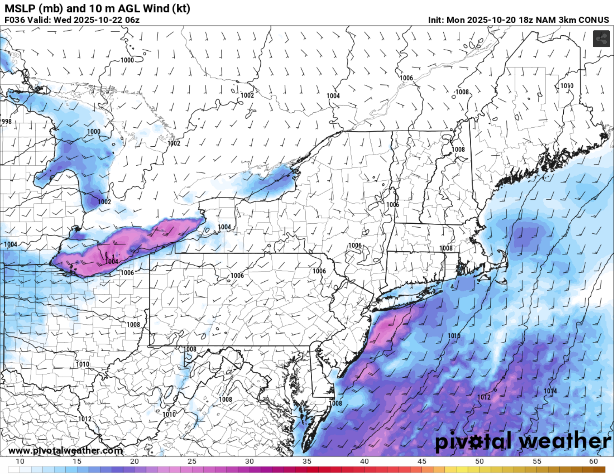
As the center of the low continues to the east throughout Wednesday into Thursday, the wind direction will shift to a more NW direction (northwest flow) and eastern Lake Ontario and east of Lake Huron begin getting in on the rainfall. Note the WNW/NW flow on Lakes Erie & Huron (though this is as far as some Convection Allowing Models go at this point).
Strongest convection over the lakes may have lightning associated with it and I fully expect to see some waterspout reports.
When it’s all said and done, some localized areas within the familar snow belt areas on the north and south shores on the eastern side of Lakes Erie, Ontario and some areas east of Lake Huron may see 50 mm+ of rain over a few days and are dependent on where rain bands set up (based on wind direction) and their duration for those localized areas.
If you’re reading this from within the snow belt areas, you’ll know exactly what I mean. Neighbouring towns seeing rainfall and your town staying dry. The extent of colder air aloft and timing of low arrival/residence time will influence the amount of rain that falls.
In short, if you hate snow, you’re lucky this wasn’t a stronger, colder low, or wasn’t a bit later in the season.
Lastly, say goodbye to the last of the leaves in the coming weeks. These storms are likely to knock a good percentage of them away. This was a bit of a down year for vibrant leaves because of the very warm and dry conditions compared to previous seasons.
I’ve enclosed some pictures of this year below (so far), but when you compare them to some of my previous years, it’s no comparison. The link will be here for other years.


