
Localized Flash Flooding…Again...On August 2nd. The Second Event In 14 Days
St. Catharines and areas east of Hamilton, Ontario saw 4+ inches of rain in a day. For some areas, the second time in 14 days.

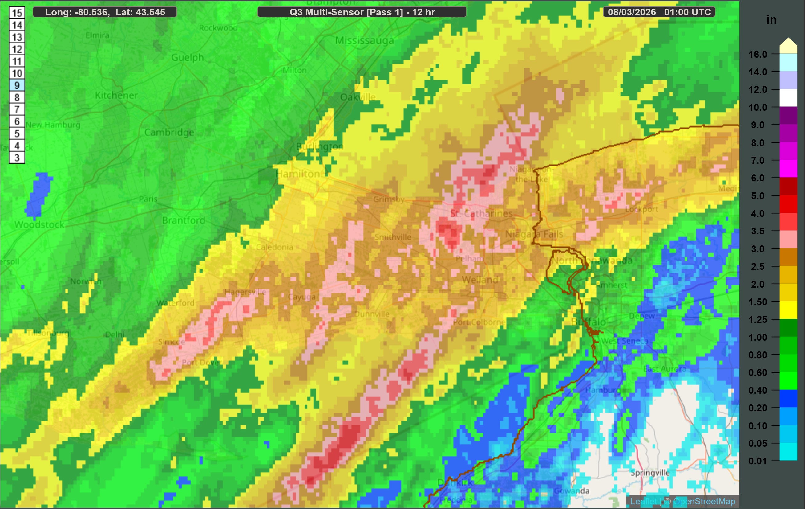
On August 2nd, efficient rain process convective thunderstorms led to localized zones of high rainfall totals across Southern Ontario...again. For some, it’ll be the second time being flooded in two weeks. Areas near Simcoe and parts of the Niagara Region (Grimsby and St Catharines) received plenty of rain throughout the day, as we’ll discuss.
Unlike the last event, which was far more localized due to a smaller boundary as the focus for repeated initiating storms, this event was more broad in coverage. Areas east of the community of Simcoe, the western Niagara region (my area), and especially St Catharines (who were the hardest hit) saw upwards of 3-5 inches (125 mm+) of rainfall throughout the day, and quite likely higher in some regions. The rainfall came in two prominent bursts: one in morning (from around 8am EDT through noon) and the other around 7pm through 10pm EDT.
The town of Grimsby now has a total of 200+ mm (7.8 inches) of rain over 14 days. Local areas nearby have almost certainly recorded higher. It has been a wild two weeks in terms of rainfall for the area.
Synoptic Setup
To reiterate from my previous article, flash flood prediction is a complex mix of synoptic and mesoscale meteorology, timing (when storms form and how long storms stay over a particular area), and topography. The basics, in summer, involve heavy rainfall for a long duration in an area that can’t absorb it quick enough, does not allow for a quick run off, or areas near a stream or river that will swell downstream, which typically happens after storms have moved on.
With the rainfall deluges hitting the area over the last two weeks (and smaller rainfall amounts in between the major days that prevented drying out), the ground has retained moisture, preventing a high rate of absorption. In St. Catharines, the rates of rainfall proved to be too much, too quickly, leading to flash flooding.
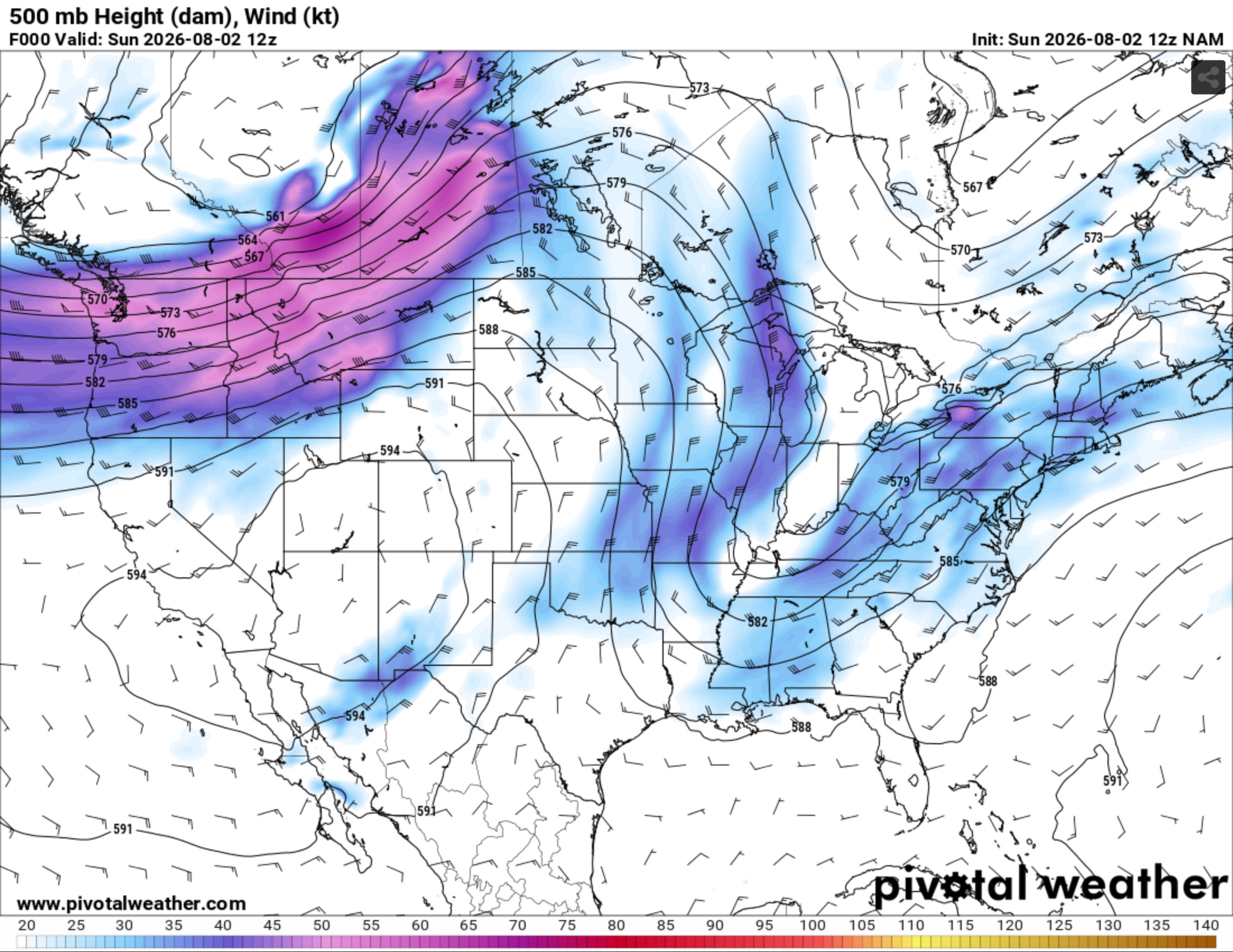
The difference with this event vs the July 21st event was the presence of a slow moving, positively tilted trough that was set up over the northeast. It is impossible to miss below.
However, unlike the smaller boundary of July, this event did feature a larger stationary front that spanned across Lake Erie and Ontario and became a source for storm initiation throughout the day across the regions of interest. Numerous storms would fire near, or on, this boundary throughout August 2nd, leading to repeat areas seeing heavy rain.
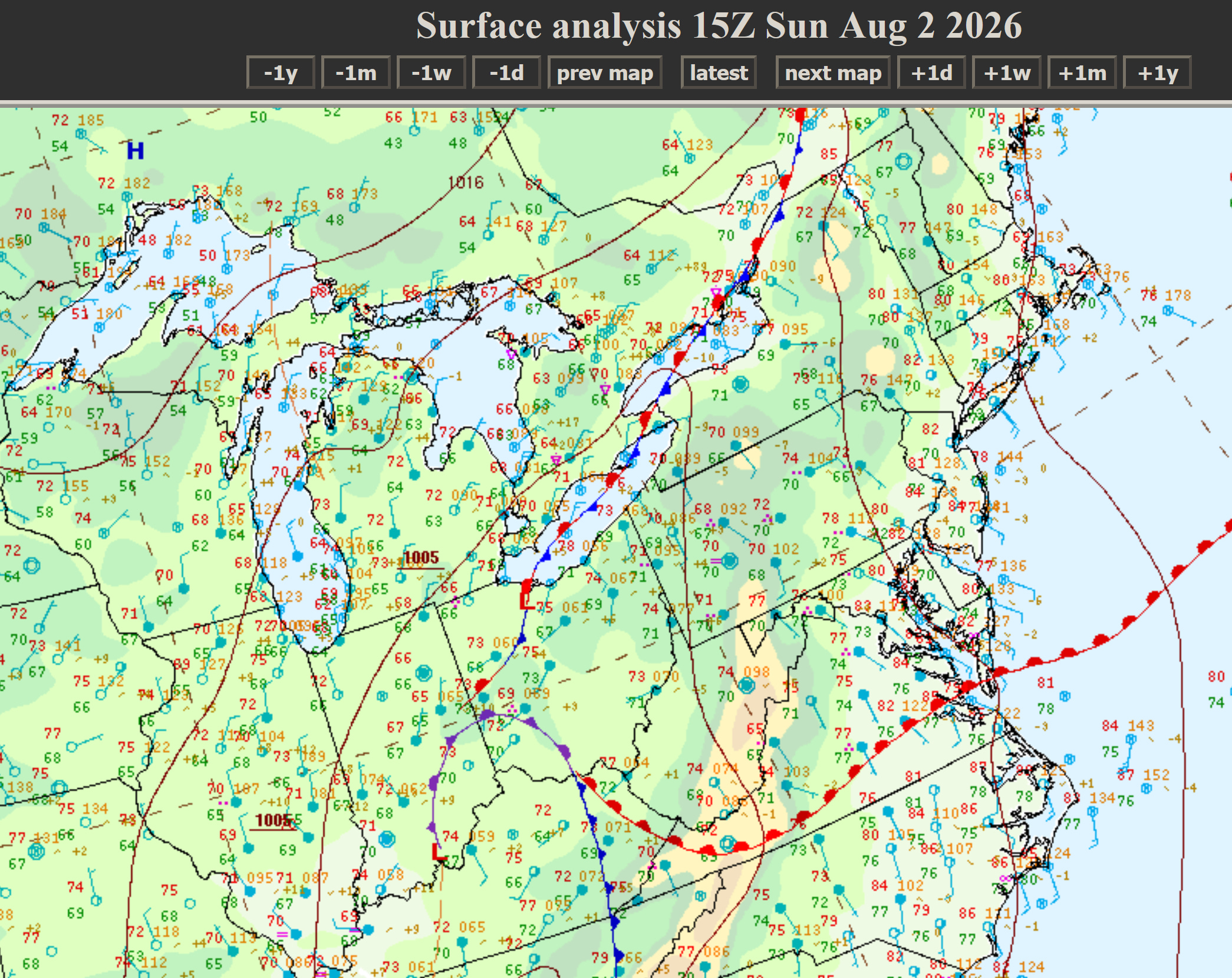
In the case of the heavy rainfall, in addition to the notable trough and surface low listed above, this was due to:
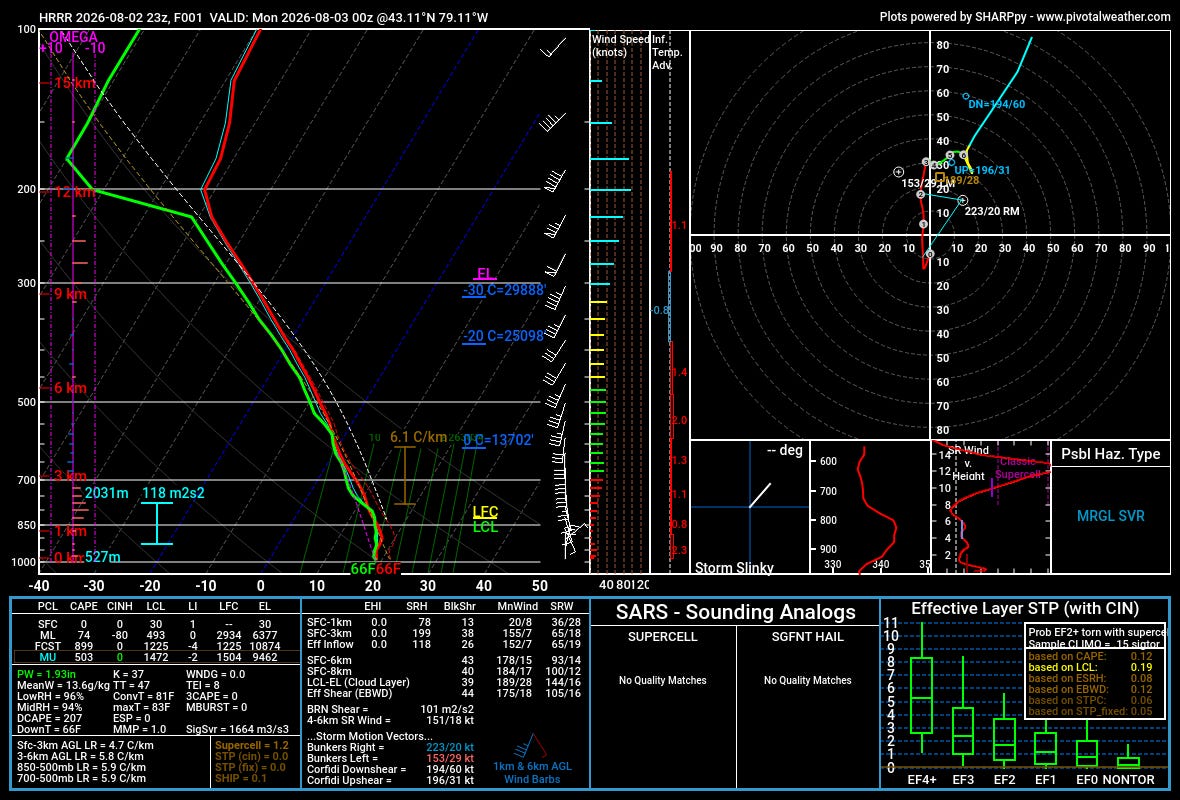
Convective storms (thunderstorms) dropping heavy rainfall over the same areas, with east Hamilton through St. Catherines seeing at least two rounds of slow moving storms. Strong shear in all but the lowest layers of the atmosphere allowed for organized convection, though much of it was elevated throughout the day (there was little to no SBCAPE, or surface energy). Most soundings in that area east of Hamilton were highly saturated, noted by the very high low and mid level relative humidity, and high precipitable water totals (PWAT of 1.93 inches). The stage would be set for storms that form to be very efficient rain producers, which did form along that stationary front.
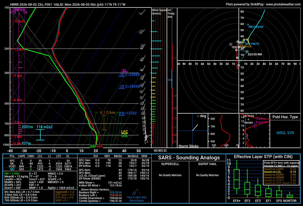
Note the sounding around 00z (8pm EDT) around St Catharines around the time of the heavy rainfall. Little to no surface energy is available, but there was plenty aloft for elevated storms. Also note the saturated sounding going up past 500 mb. This was a very efficient rain producing environment.
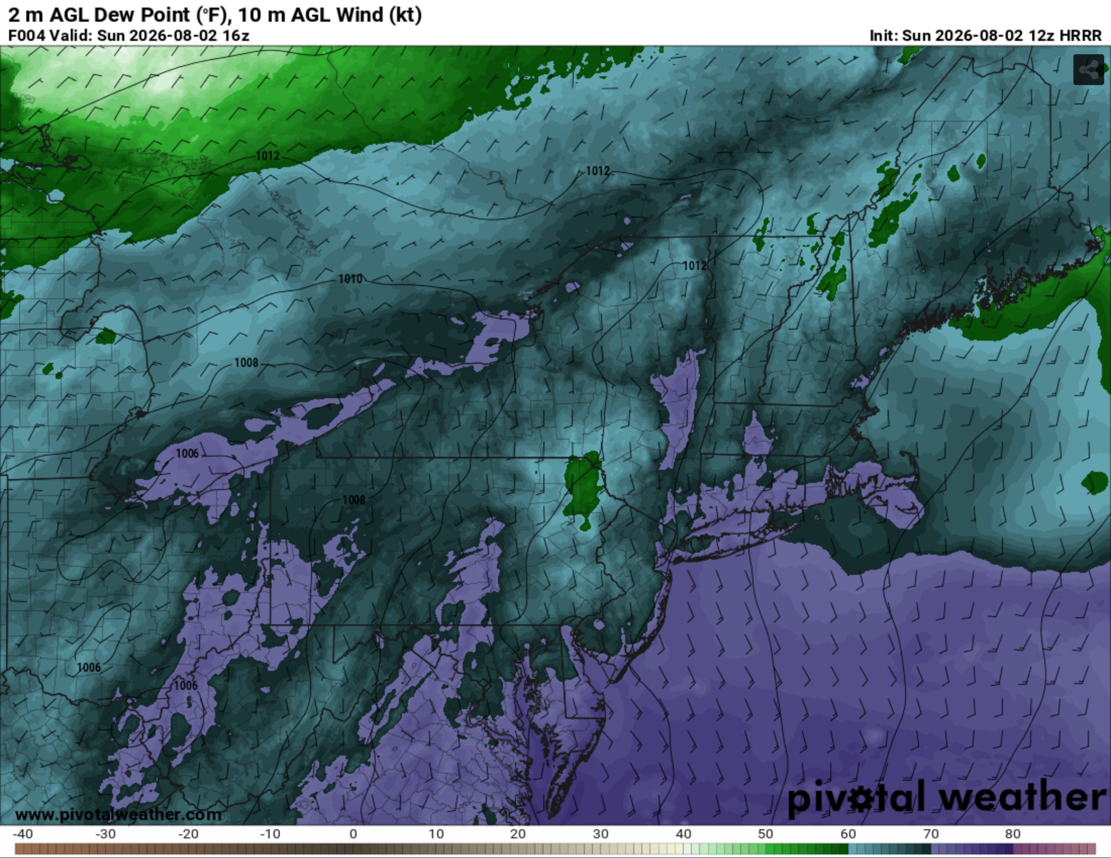
A very moisture rich environment, at the surface and aloft (high dew points in the upper 60s to low 70°F) and good enough energy aloft for thunderstorms to form (estimates of the area exceeding 500 J/kg of MUCAPE). This allowed for elevated convective storms with a deep layer, highly efficient rainfall process (leading to very high rainfall rates) to form and slowly move over the same areas.
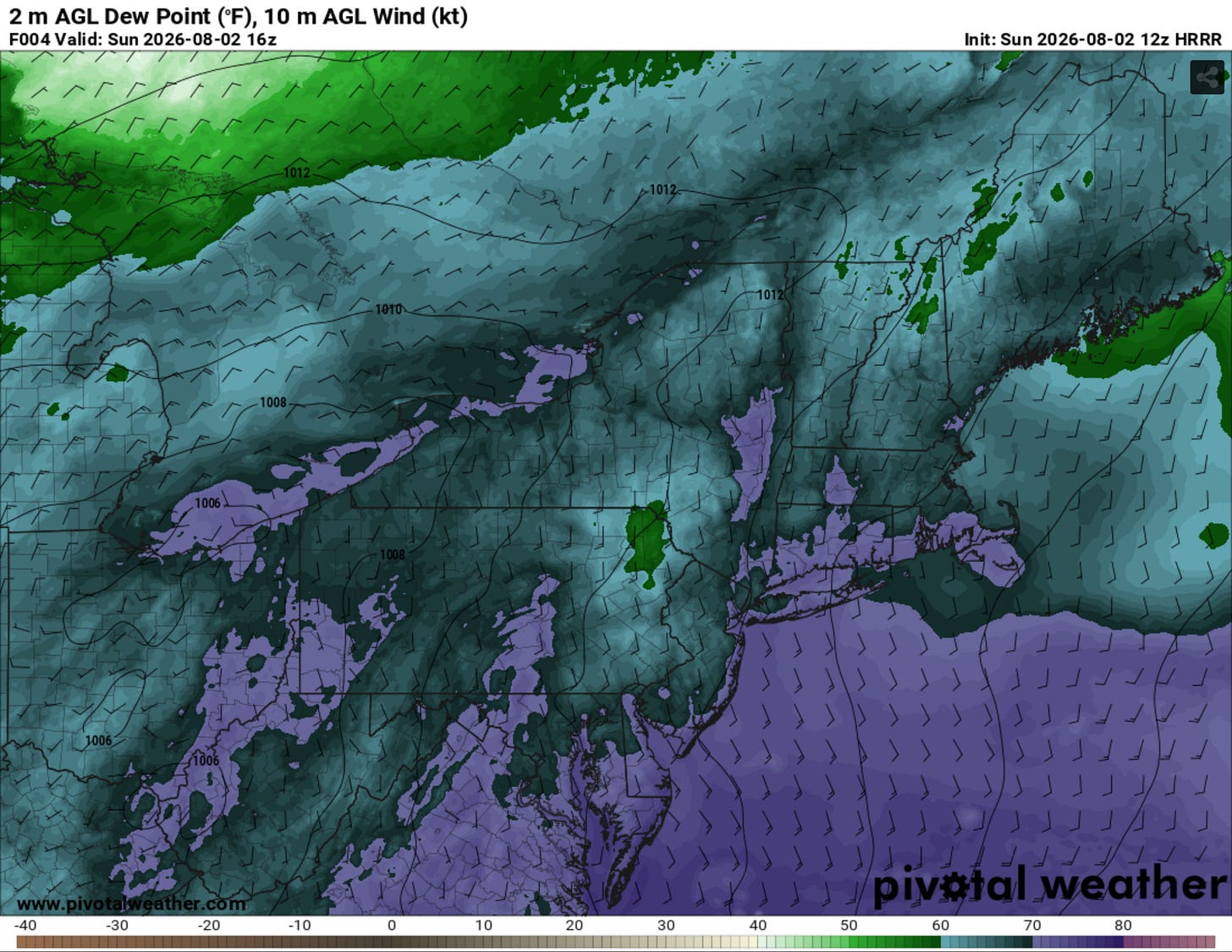
Note the very moist environment in place throughout the zones of interest.
Two Major Rainfall Events
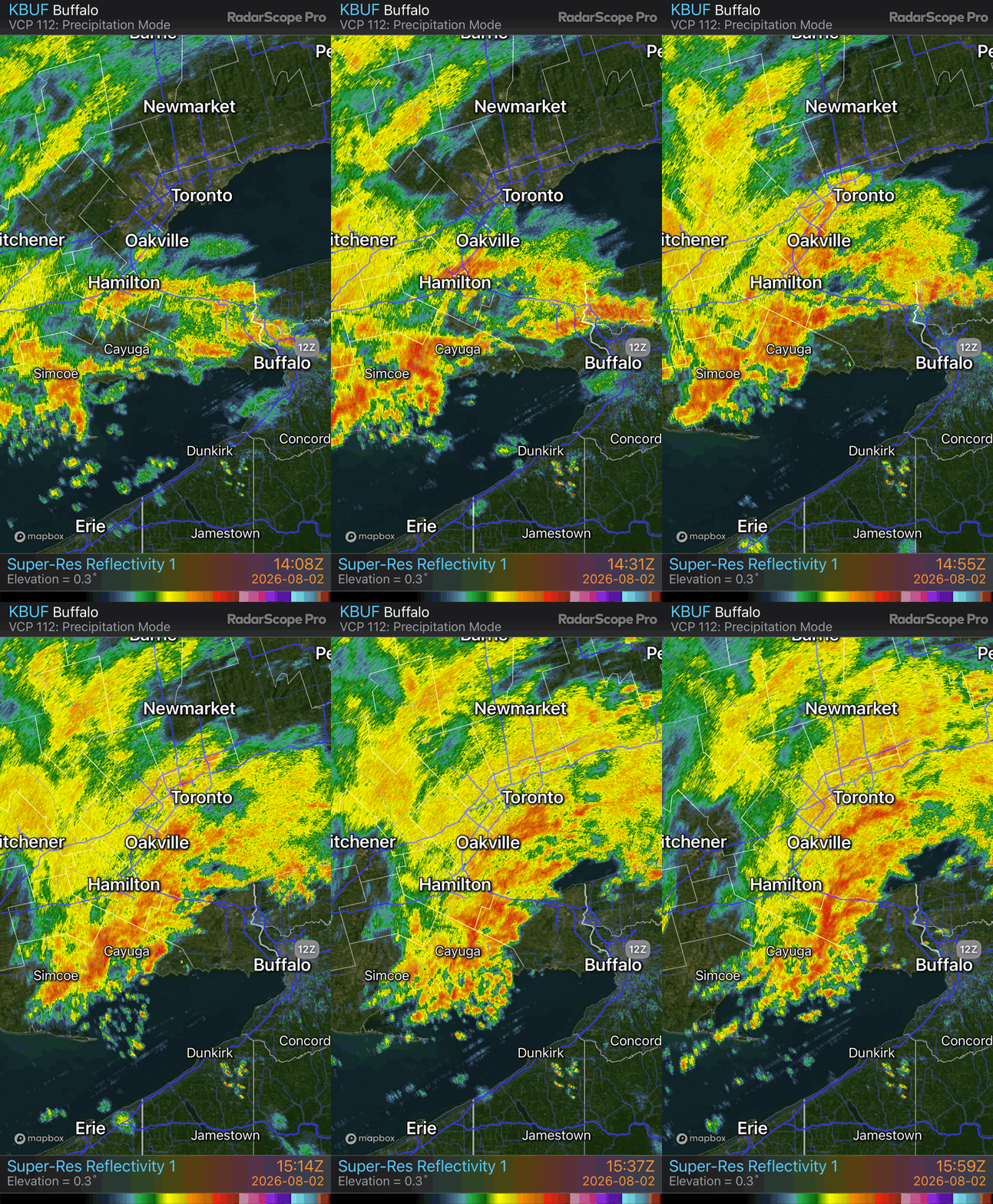
With storms forming near and along this stationary boundary, the result was two notable waves of precipitation (among lighter rounds during the day). This is the estimated rainfall outcome of wave one in the morning.
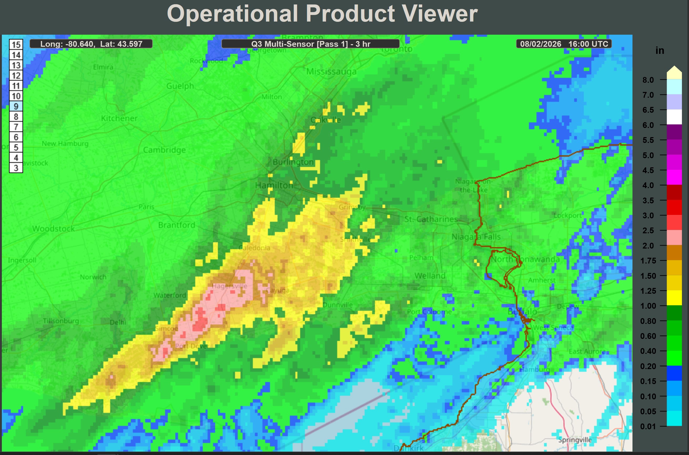
The first wave, which the radar loop will illustrate below, shows my region getting approximately 1.5 inches of rain and the surround areas of the community of Simcoe seeing the highest totals (approximately 2+ inches). This event was more of a primer for the Niagara region and not the main event itself, which would come later in the day.
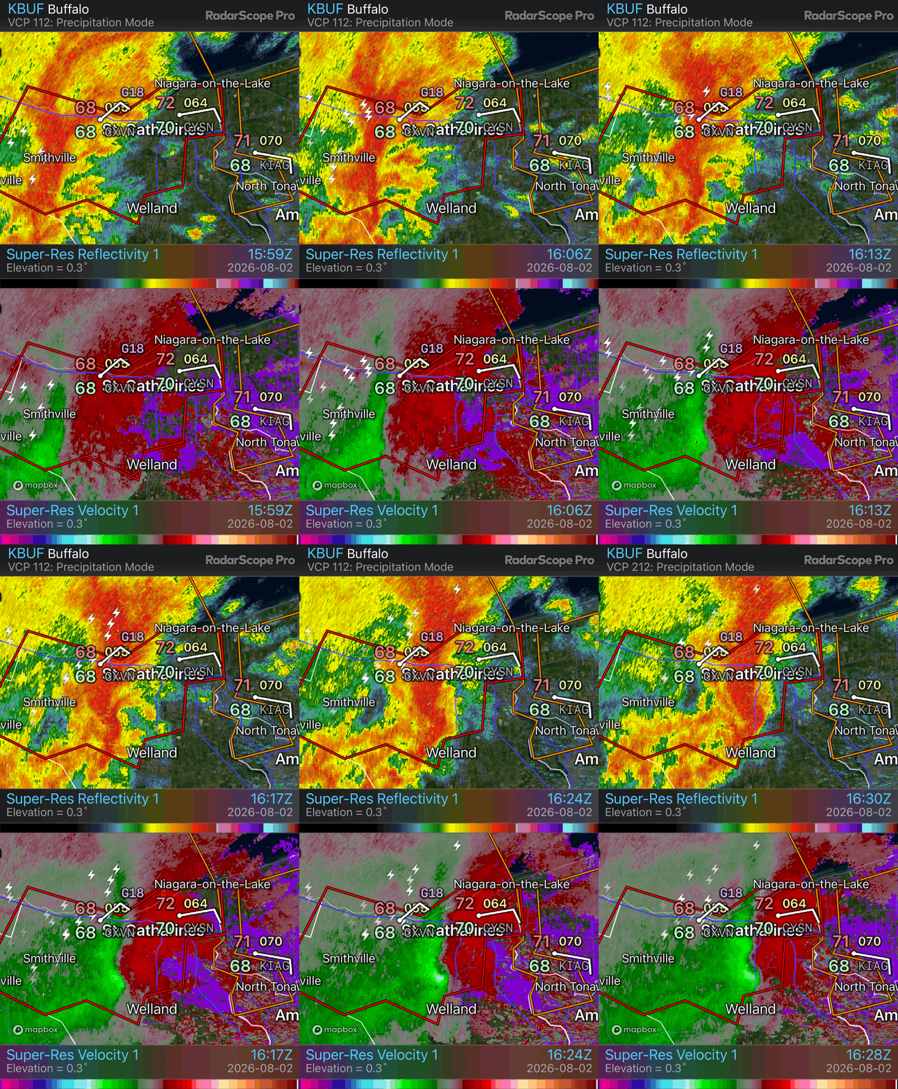
Wave one also produced a tornado warned storm as it passed through Fonthill and into Buffalo around noon. I have not seen any confirmed tornado reports at the time of writing.
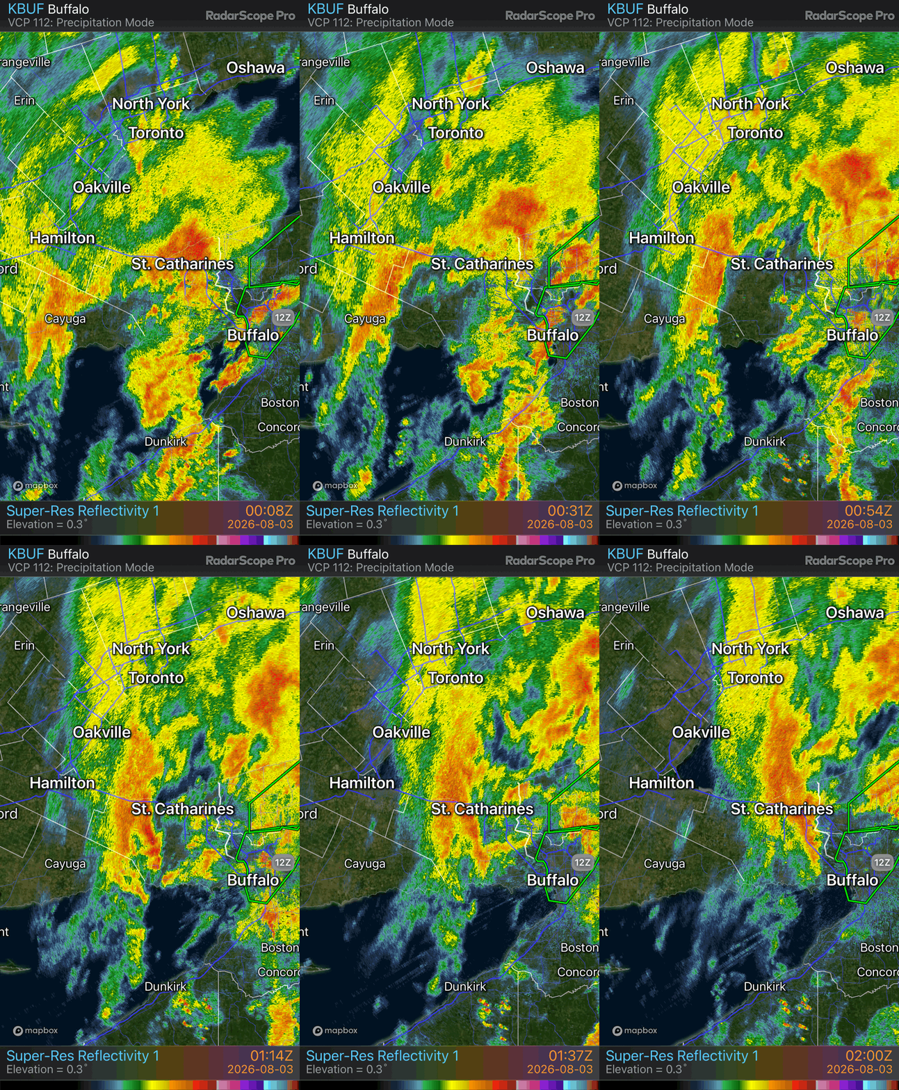
The second event, really the main event, of heavy rain began around 23z (7pm EDT) as the surface low passed through and pivoted out of the region. Storms that formed at this pivot point stalled, dropped several inches of rain, then slowly left the area after around 03z (11pm EDT).
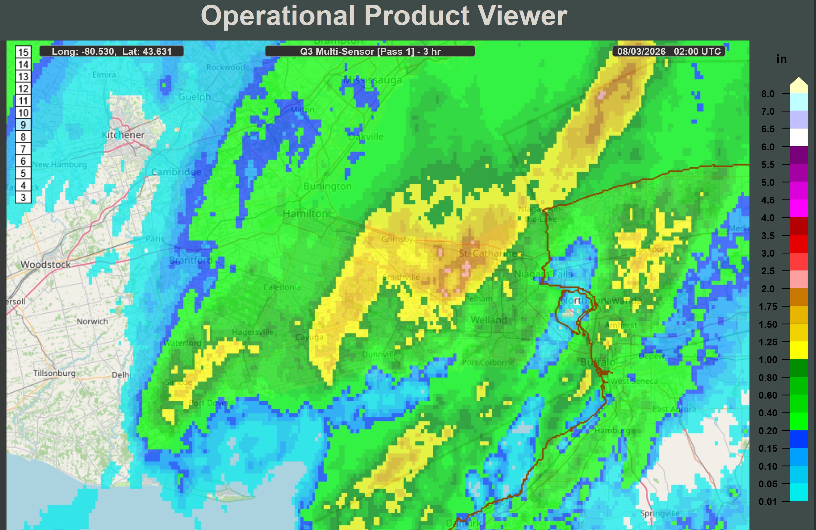
There were several Instagram videos showing the flooding across St. Catharines. That area, specifically in the northern part of the city, saw perhaps 3-4 inches of rain in the three hour stretch from 23z through 02z (locally 7-10pm). This was in addition to the rainfall they received earlier in the day. It is possible, given some of the videos coming out, that localized totals in that areas are higher than projected here.
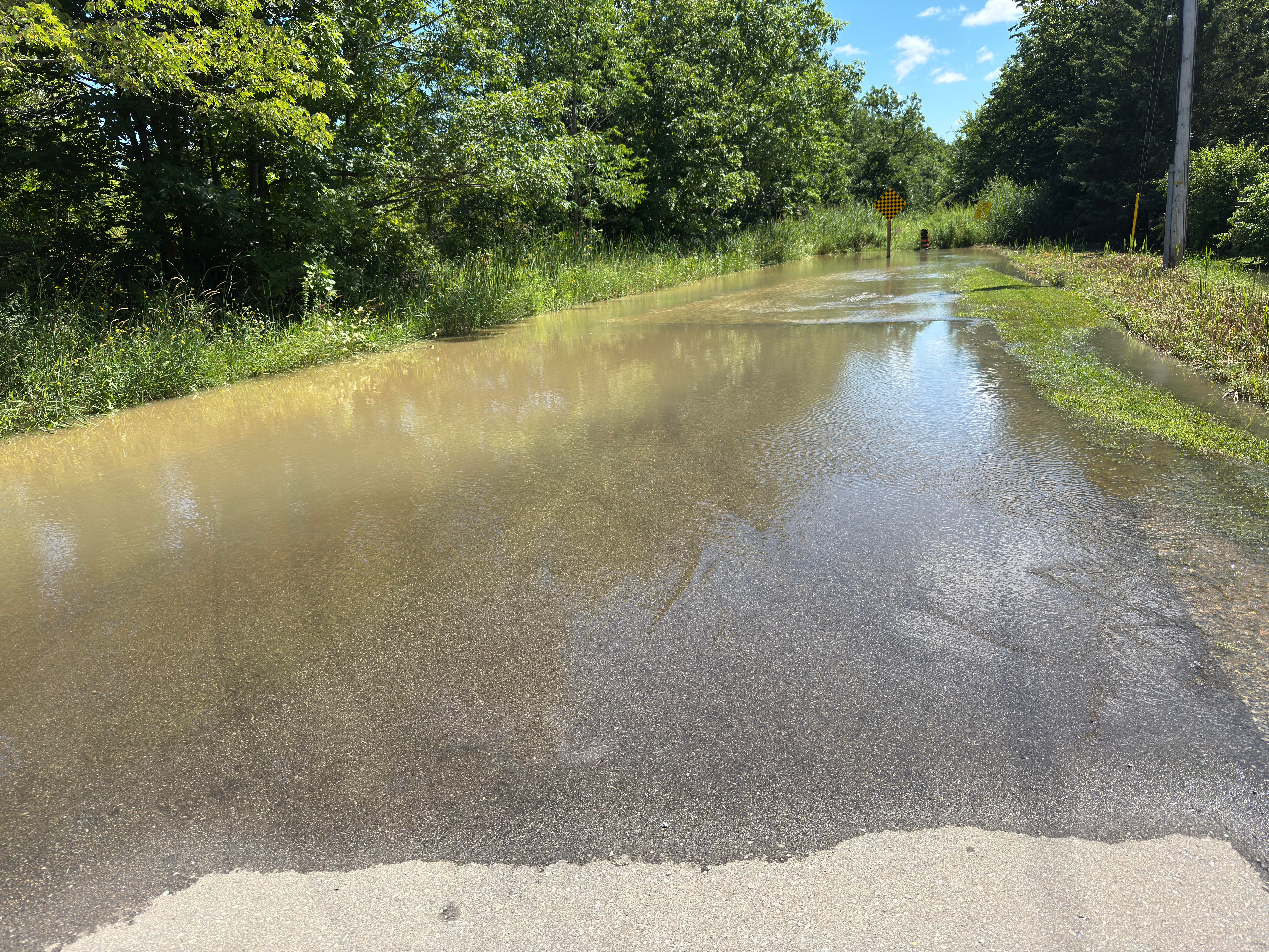
Below is my area being flooded again. How the flooding typically works in this area, like most others, is the peak crest of the flooding occurs well after the rain stops. This was around 10 am EDT, meaning the peak occurred overnight. Like I mentioned on July 21st, this is the time of year that they’d struggle to have any flow in them at all, but this is the second flood in 14 days.
The cold front coming through the area overnight, once again, alleviated the area from rainfall and higher dew points. It is much more comfortable outside. It should be quite nice for a few days, where more rain may occur. Thanks for reading!